
Anasphere Tethersonde Systems
Systems for atmospheric profiles within the lower troposphere
SmartTetherTM is a tethersonde system developed for boundary-layer profiling and near-surface meteorological measurements. One or more flight modules are deployed on the tether of a blimp, kite, or similar platform. A free PC-based program (Windows XP or newer) operates the system, saves data in a file, and can display data in real time. A single ground station is connected to a PC to communicate with the modules. Any number of modules may be operated through a single ground station. Data may be collected at up to a 1 Hz rate for up to eight modules; using higher numbers of modules will lead to gradual reductions in maximum data rate.
SmartTether has been specifically designed to be a flexible, multipurpose atmospheric profiling system suitable for a wide range of applications. Therefore, it uses a comparatively higher-powered telemetry system which enables ranges of up to six kilometers. This extended range comes at the expense of shorter battery lifetimes (12-24 hours depending on battery type) as compared to some of our smaller tethersondes.

Key Features and Benefits:
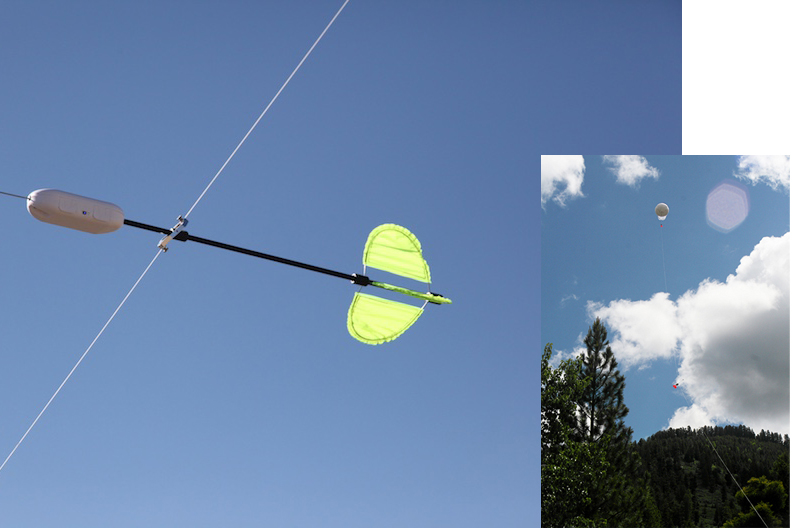
Anasphere SmartTether™ System
- Allows users to collect data simultaneously at multiple points along a tether
- Orders of magnitude faster than traditional tethersonde systems (1Hz for 6 modules)
- No practical limit to the no. of SmartTether modules used in a system
- Less expensive than traditional tethersonde systems
- Standard SmartTether modules measure P, T, U, WS, WD
- Extra analog and digital inputs for 3rd party sensors
- SmartTether Ground Station/Receiver interfaces directly to standard PC
- SmartTether modules operate for up to 12 hrs @ 1 Hz using lithium or alkaline batteries
Technical Specifications:
Mechanical and Environmental
Mass with batteries, pitot version: 275-295 grams depending on battery type
Mass with batteries, cup version: 445-465 grams depending on battery type
Operating temperature range: -40°C to +50°C
Maximum wind speed: There is no defined maximum wind speed. The anemometer will stop indicating above its maximum value.
Electrical Power consumption: 225 milliwatts average (75 mA at 3.0 V)
Power Supplies: Either install two AA batteries in the on-board holders, or supply 0.65 – 6.5 volts DC via J1 on the circuit board (no connector is provided
Operating Lifetime: Two AA lithium cells (Energizer L91) can operate the SmartTether module for approximately 24 hours at 1 Hz.
Maximum telemetry range: 6 km in clear outdoor environment
Sampling Period: 1 second to 60 minutes, with specific available periods.
Sensors
Pressure: resolution 0.1 mb, accuracy 0.5 mb, range 0-1100 mb.
Temperature: resolution 0.125°C, accuracy 0.5°C, range -55 to +125°C
Relative Humidity: resolution 0.1%, accuracy 1.7%, range 0-100%
Wind Speed (pitot anemometer): resolution 0.1 m/s, accuracy 0.5%, range 0-14 m/s (at sea level), 0-22 m/s (at 5,000 ft MSL); extended ranges with reduced resolutions are available.
Wind Speed (cup anemometer): resolution 0.1 m/s, accuracy 0.1 m/s or 5% (whichever is greater), range 1-59 m/s
Wind Direction: resolution 1 degree, accuracy 2 degrees